The best interface to the POGO is the one already in your pocket.
Sample & Log
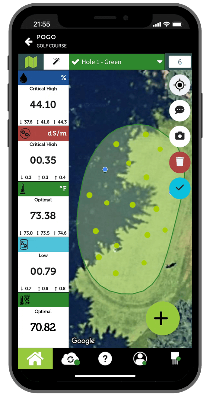
Log 4 soil parameters (5 with POGO Pro+) and the precise location (within 1 m or 3 ft.) with every sample. Simply stick the POGO in the turf and tap the “Add Sample” button. Each new moisture, salinity (EC), salinity index and temperature sample is color-coded according to your customized optimal and warning ranges.
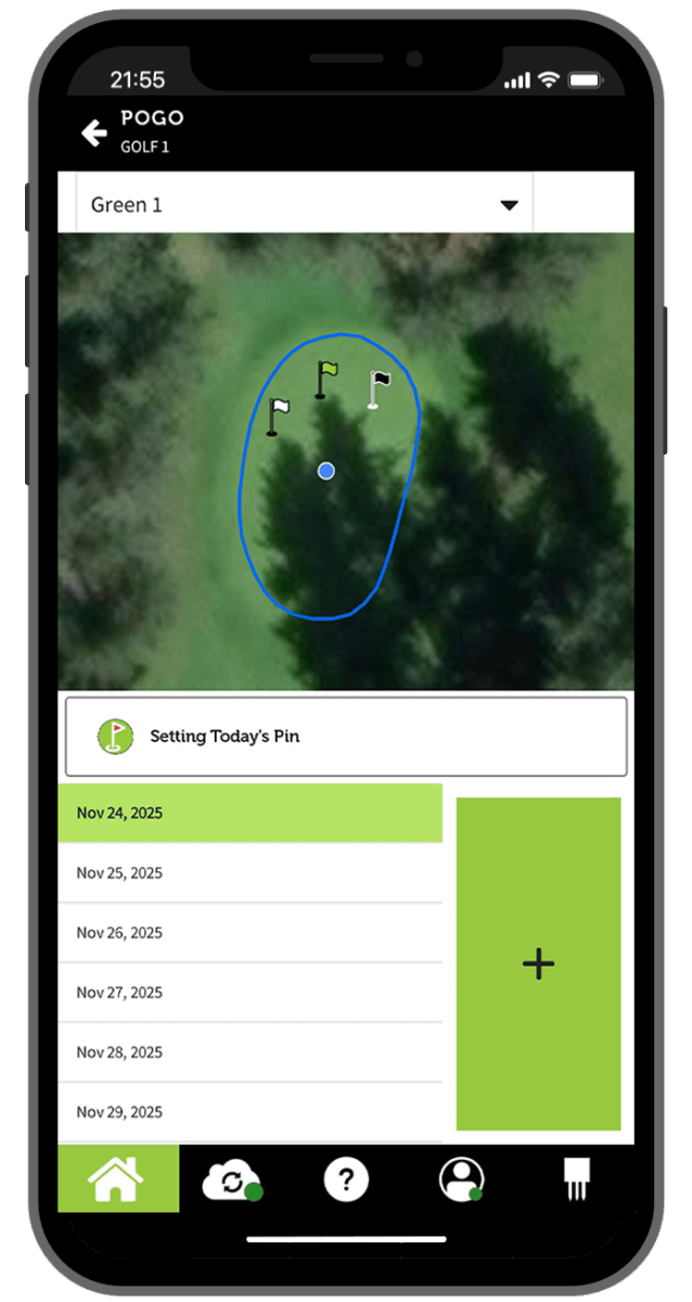
Pin Mapping
Use the GPS to find past pin locations, and set where you want today’s and future pin locations to be placed. Cross-reference against past and predicted moisture and EC data to ensure you’re selecting optimal locations.
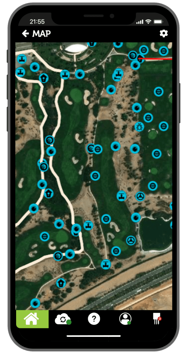
Course Overview
Full satellite mapping functionality that you already know how to use—pinch to zoom, drag to pan, etc. View the current moisture, EC, salinity index and temperature conditions for the entire course, then zoom in to the trouble spots.
The free TurfPro Mobile app turns your Apple or Android smartphone or tablet into a data acquisition and logging system that collects, displays and logs turf conditions measured by the wirelessly-connected POGO.
The app displays real-time analytics and assessments of turf/soil moisture, salinity and temperature. This allows for timely reaction to conditions that could lead to costly problems.
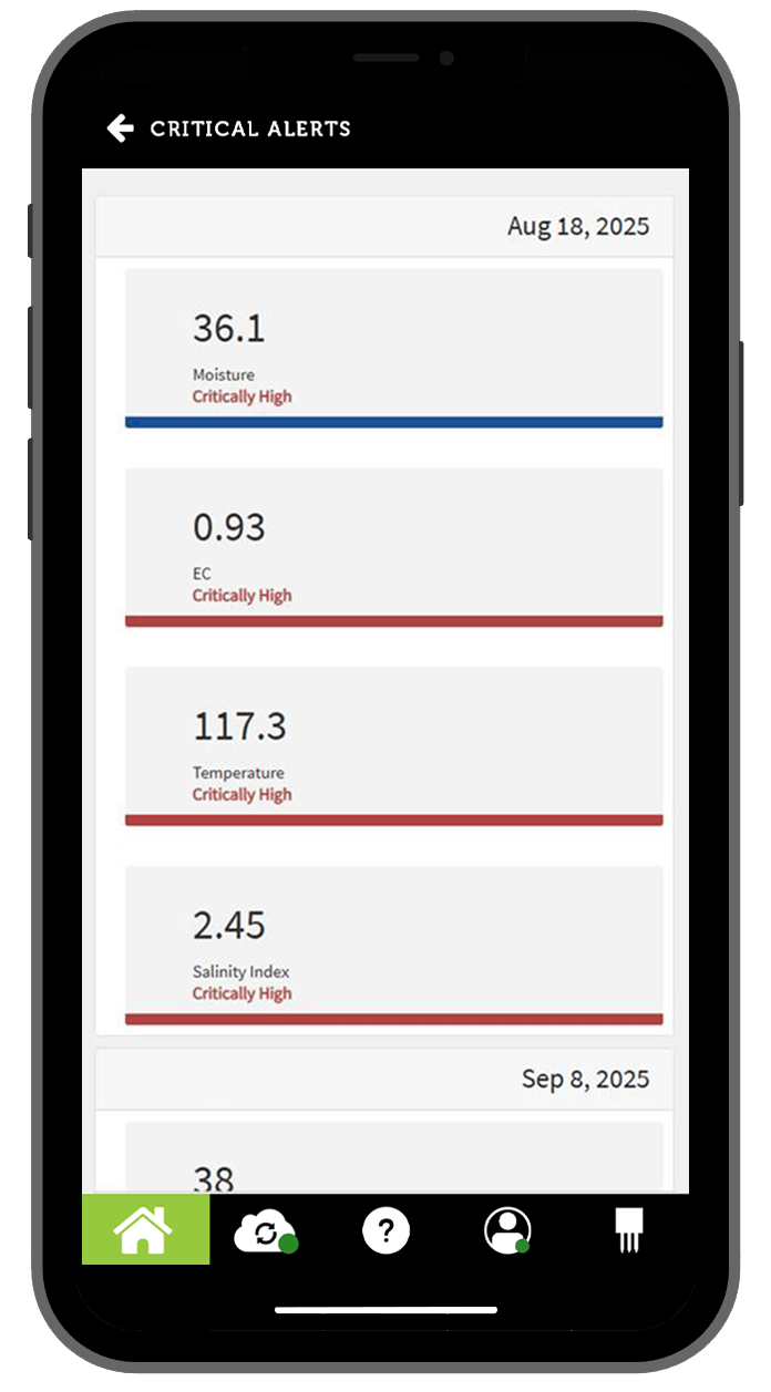
Critical alerts advise you of conditions measured that require immediate attention while you are on the course.
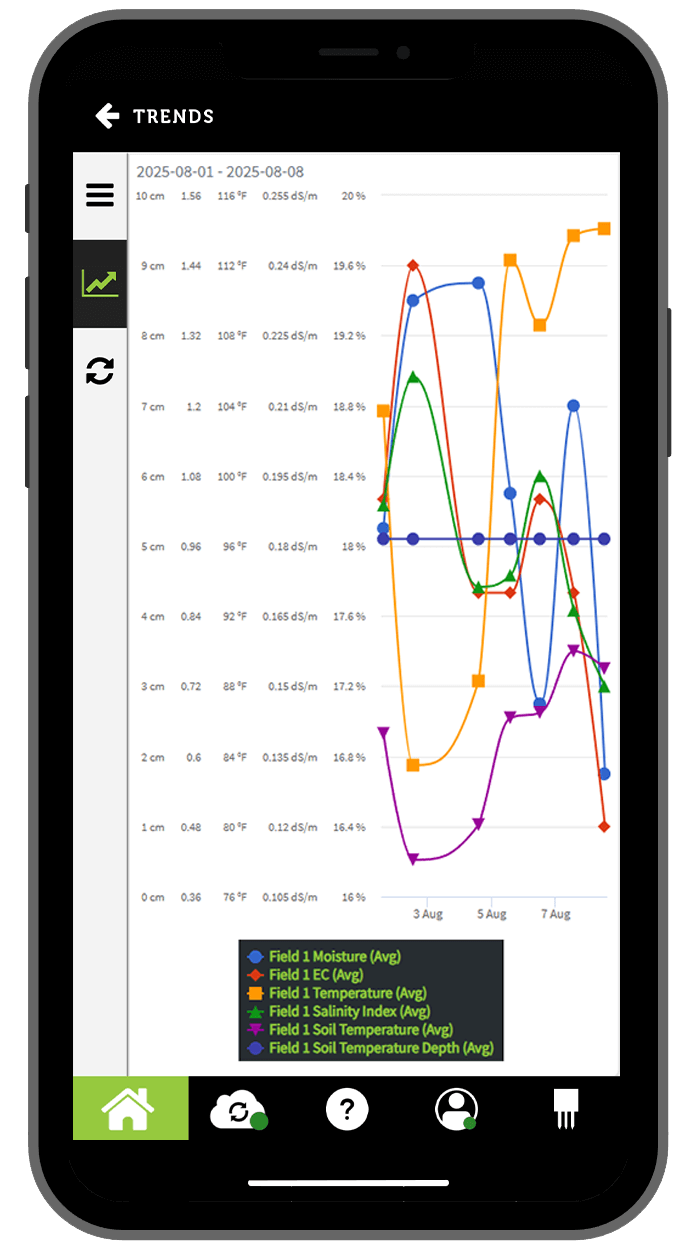
Easily synchronize data with TurfPro Cloud and unleash unprecedented insight and analysis.
Data and configurations are shared with all other users on your team, allowing a property to be split between multiple people, yet ensuring standardized measurement.
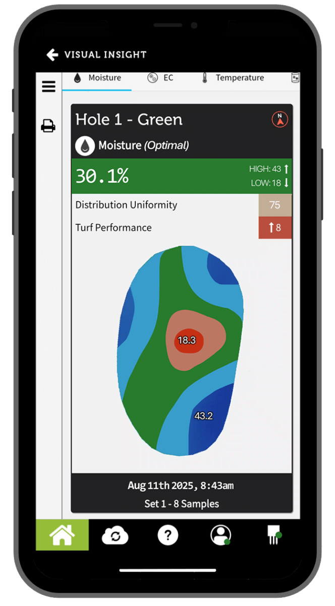
POGO’s advanced algorithms compute the interpolated values on every inch of the zone and display it as a color-coded illustration we call Visual Insight™.
Only 9 to 12 samples (which takes under minutes) for a typical green are required.
Mapping with POGO
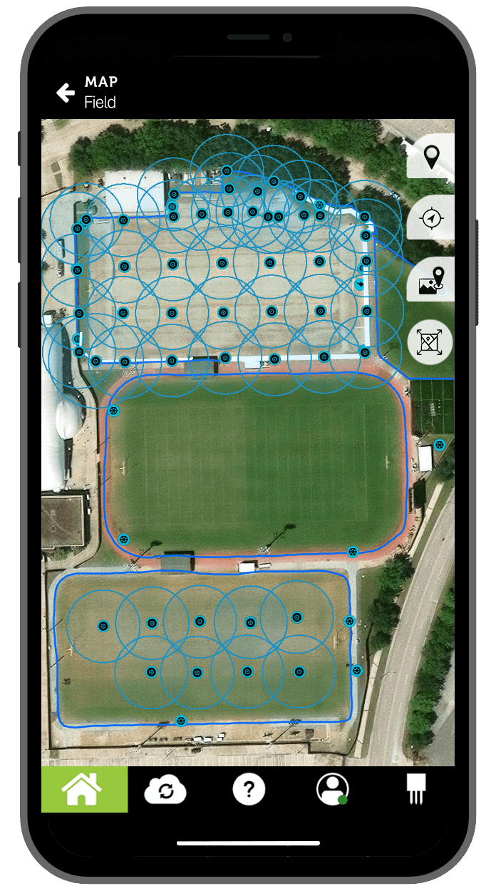
Use your POGO mini or Pro+ to accurately record the precise location of virtually anything on your property. Create your own irrigation as-built diagrams, log IPM problem areas, and map individual irrigation, drainage, and electrical components with ease.
Simply hold the POGO over a fixed object—such as a valve, catch basin, or hydrant—or walk along the path of a linear feature like a drainage line, walkway, or electrical run. All mapped features are saved as individual, toggleable layers that you can show or hide on demand.
To later locate an asset that’s buried or hidden from view, just walk the property with your POGO while viewing your live position on the map. The system will guide you directly back to the exact location of the recorded object—quickly, accurately, and with confidence.
Get the analysis you need to take action, while you're still on the green.
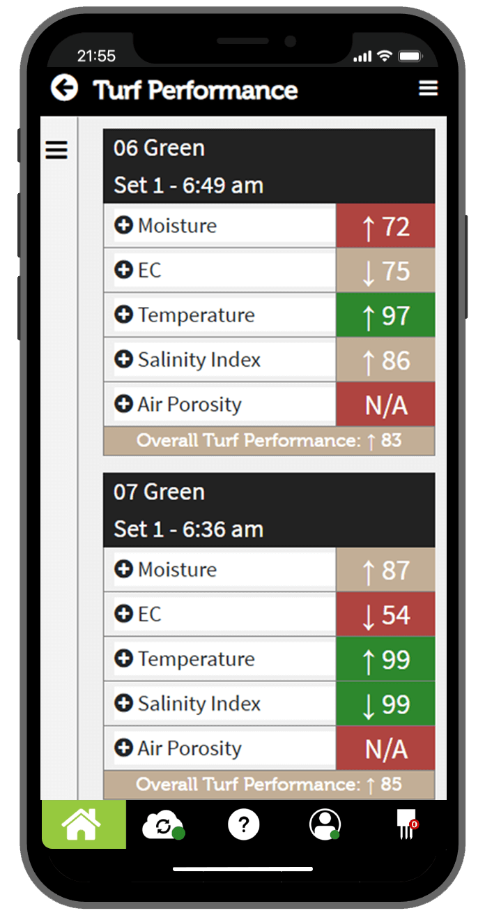
Mobile alerts formatted for mobile browsers and containing the key reports that you select, are available right on your smartphone with every upload of new data from the app to TurfPro Cloud. Reports like zone trends, Visual Insight, turf performance reports as well as critical alerts give you insight otherwise only possible using consultants, reports and research.
Analyze your course’s conditions while you are on the course, so you can make the very best decisions fast…and decisively.